
TODAY: Morning sunshine filtered through high clouds, thickening up this afternoon. A high in the low to mid 40s. Light northwest winds.
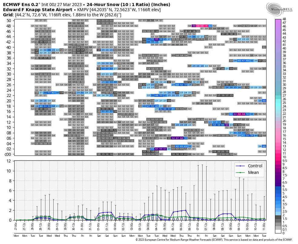
TONIGHT: Cloudy. Rising chance for rain showers mixing with wet snow Barre-Montpelier area south with a dusting to a sloppy inch. Partial clearing overnight. A low mid-20s to near 30. Light north winds.
TUESDAY: Lots of clouds with a few breaks of sun. Chance for an isolated sprinkle/flurry or two northern mountains. A high 35 to 40. Northwest winds 10 mph.
Looking further ahead
TUESDAY NIGHT: Evening clouds then clearing. A low upper teens to mid-20s.
WEDNESDAY: Morning sun gives way to more clouds in the afternoon leading to scattered snow showers/flurries with minor accumulation Wednesday evening. A high 40 to 45.
THURSDAY: Partial sun gives way to more clouds. A period of light accumulating snow showers or flurries late. A low 20 to 25. A high 30 to 35.
FRIDAY: Brief morning sun then increasing clouds. A rising chance for mixed snow and rain showers with minor slushy accumulation. A low upper teens to mid-20s. A high 40 to 45.
Average lows ranging thru the 20s. Average highs mid to upper 40s
Start of Meteorological summer arrives June 6th.
RH/3-27 forecast][end]
