
TONIGHT: Cloudy. A few rain showers developing northern areas about late evening on. A low mid to upper 30s. Light southeast winds.
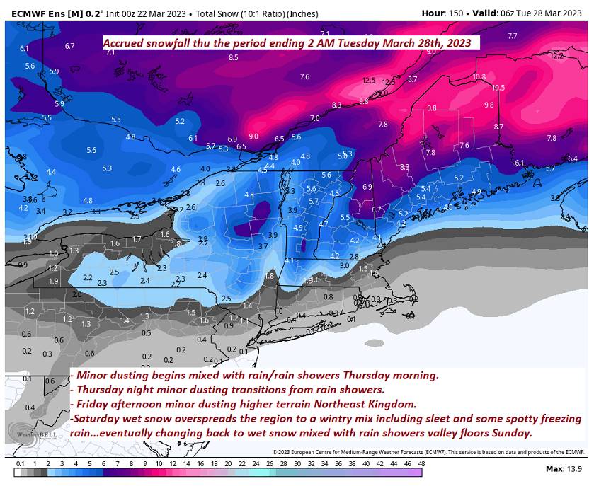
TOMORROW: Gray.Light rain or rain showers developing…possibly moderate for time in the afternoon. Maybe a few wet snow flakes higher terrain. Areas of fog possible. A high mid to upper 40s. Light south winds.
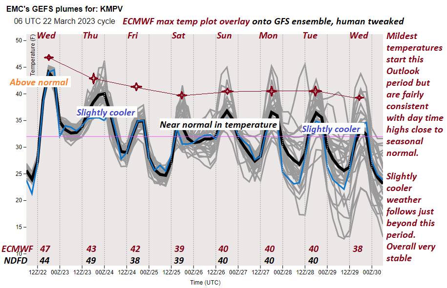
THURSDAY NIGHT: Variable clouds. A few evening rain showers northern areas. A low in the upper 20s. West to northwest winds pick up to 10 to 20 mph.
FRIDAY: Early clouds, then increasing amounts of sunshine & blustery. A high 35 to 40. Northwest winds 10 to 20 mph.
Looking further ahead
FRIDAY NIGHT: Fair with high cloudiness. A low 20 to 25.
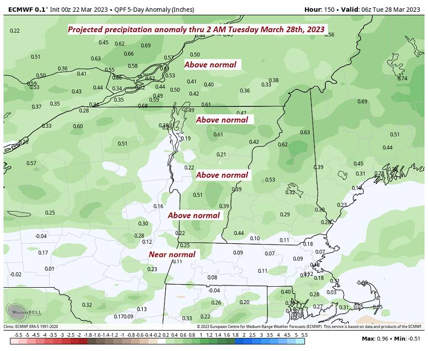
SATURDAY: Thickening clouds. Chance for a periods of wet accumulating snow leading to a wintry mix Saturday evening. Slushy slippery travel with a couple to a few inches possible. Breezy to windy late. A high near 35.
SUNDAY: Mainly cloudy. Chance for leftover wet snow showers mixed with rain valleys. A low 30 to 35. A high in the upper 30s.
MONDAY: Mostly cloudy with a chance for leftover flurries early. A low upper 20s to around 30. A high in the low 40s.
TUESDAY: Mostly cloudy. Chance for light snow or snow showers. A low Around 32. A high 40 to 45.
Average lows upper-teens to middle 20s. Average highs 40 to 45.
Start of Meteorological summer arrives June 6th.

RH/3-22 forecast][end]
