
Wind Advisory for Windsor County South in this evening
TONIGHT: Mainly cloudy & continued blustery. Accumulating snow showers developing northern mountains with 1 to locally 3” elsewhere a dusting to an inch. A low in the lower 20s. Winds becoming west to northwesterly 10 to 20 mph.
TOMORROW: Lots of clouds with any morning flurries drying up. Sunshine developing late morning on. Colder with a high in the upper 20s. Blustery northwest winds 10 to 20 mph early then falling off.
SATURDAY NIGHT: Clear & colder A low in the teens. Light southwest winds stronger near Lake Champlain.
SUNDAY: Lots of sunshine with some high cloudiness southern areas. Highs 35 to 40. Light west winds.
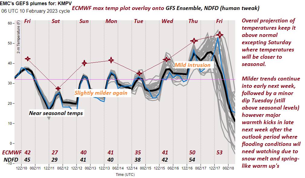
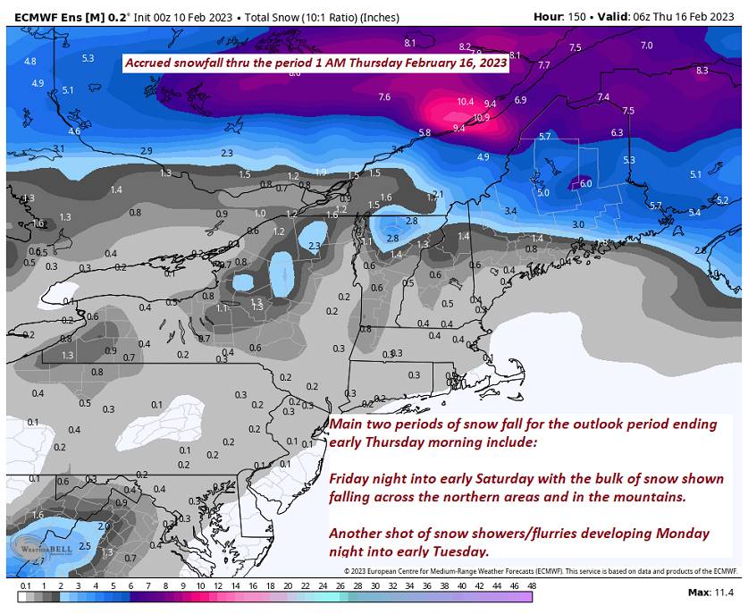
Looking further ahead
SUNDAY NIGHT: Fair with high clouds. A low 15 to 25.
MONDAY: Sunshine filtered thru high clouds. A high around 40.
TUESDAY: Morning clouds with a chance for flurries with a light coating. Intervals of afternoon sun. A low around 25. A high mid-30s to around 40.
WEDNESDAY: Hints of morning sun, then cloudy. A rising chance for a rain shower or sprinkle. A low mid-teens to low 20s. A little milder. A high 40 to 45.
Average lows upper digits to low teens. Average highs upper 20s to mid-30s.
Climatological winter ends March 9th…
RH/2-10forecast][end]
