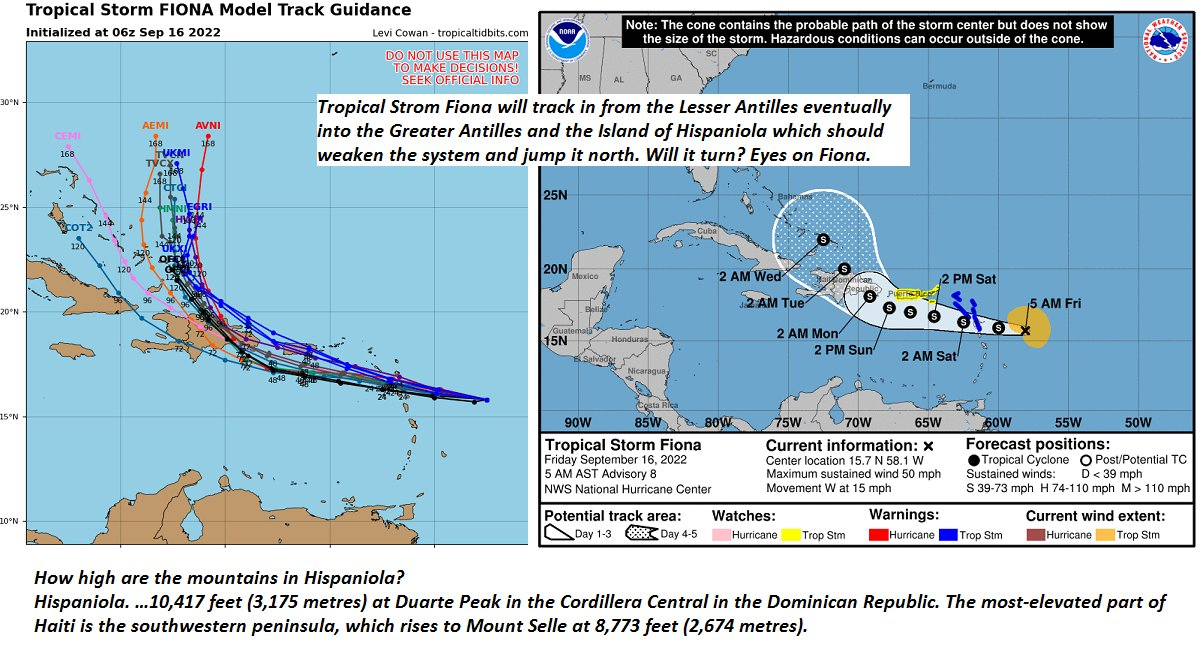
TONIGHT: Mostly clear with high clouds. Patchy valley fog. A low ranging mid-30s colder hollows with a slight risk for frost, to lower 40s. Little wind.
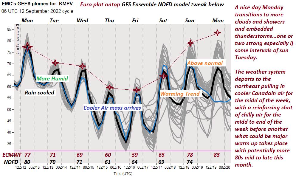
TOMORROW: Sunshine mixing with high cloudiness. A high around 70. Light south winds.
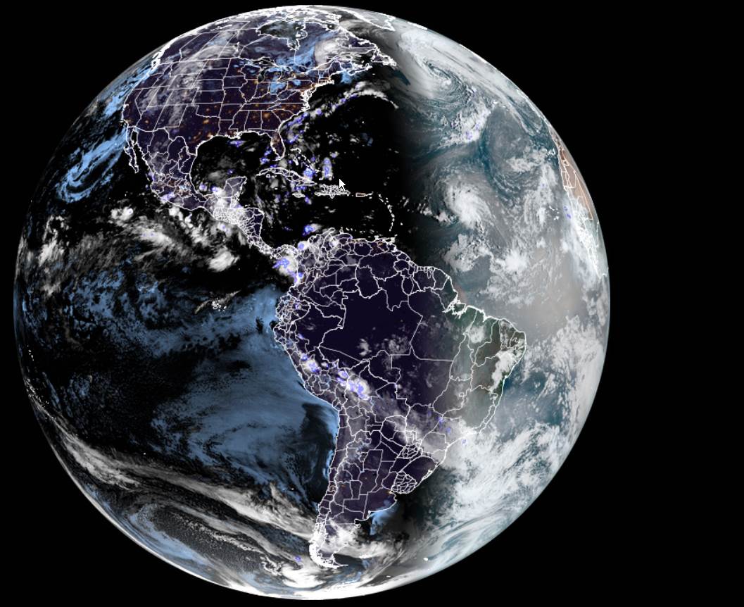
SATURDAY NIGHT: Thickening clouds, leading to a rising chance for showers northern areas overnight. A low 55 to 60. Warmest toward the Champlain Valley. South winds 10 mph.

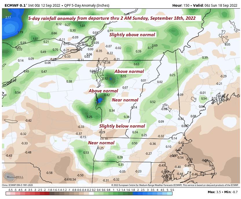
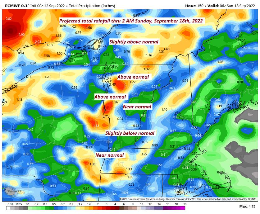
SUNDAY: Mainly gray. Showers likely, some moderate to heavy with a few rumbles of afternoon thunder late. Muggy and a bit milder. A high 70 to 75. West to southwest winds 10 mph.
Looking Further Ahead…
SUNDAY NIGHT: Cloudy. Showers likely, possibly moderato heavy at times, maybe a rumble of thunder. A low mid to upper 50s.
MONDAY: Gray. Good chance for showers & isolated thunderstorms. A high in the mid-60s.
TUESDAY: Chance for showers early then partly cloudy. Blustery to windy. A low in the 50s. A high in the mid to upper 60s.
WEDNESDAY: Morning clouds and fog, give way to partial sunshine. A low in the mid-50s. A high near 70.
Average lows mid-40s to low 50s. Average highs upper 60s to low 70s
RH/9-16[forecast][end]