
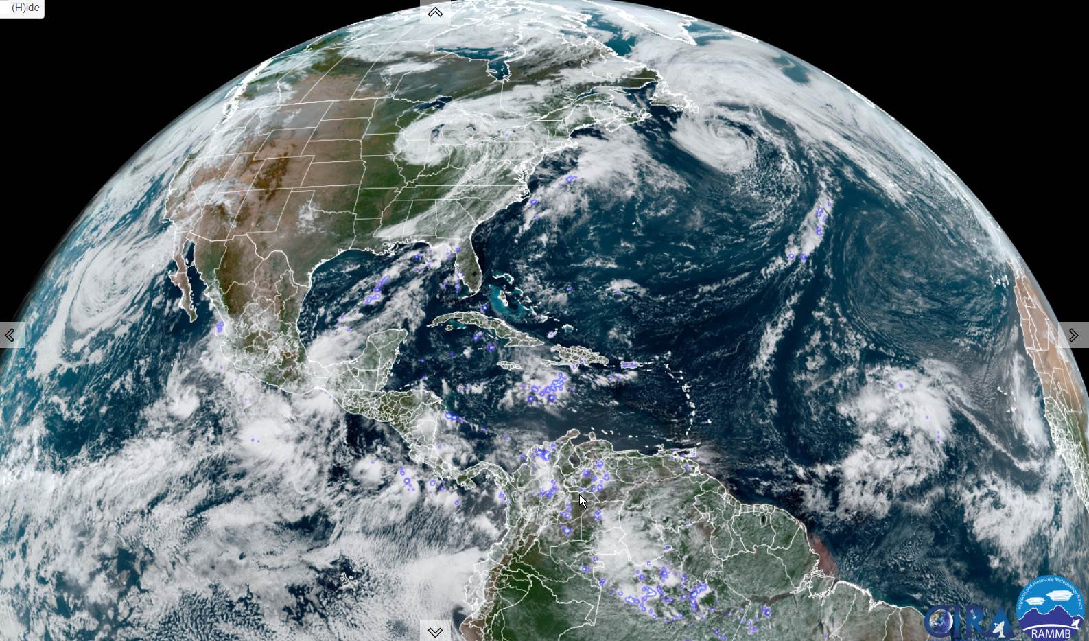
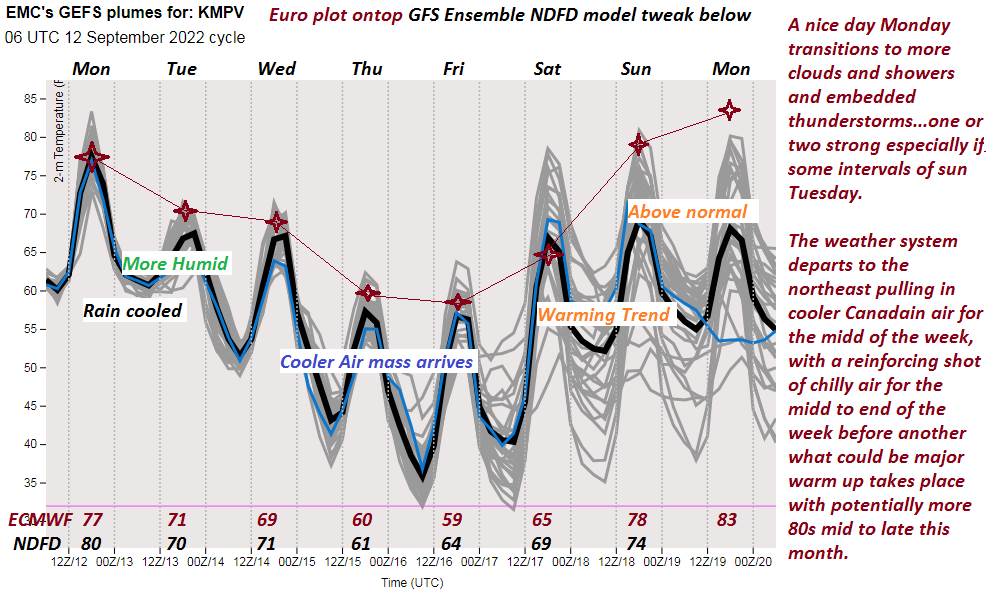
TONIGHT: High clouds lowering and thickening up. A rising chance for showers developing overnight. A low in the lower 60s. Light east winds.
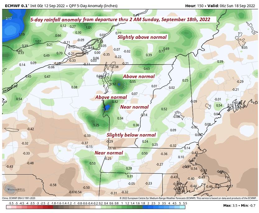
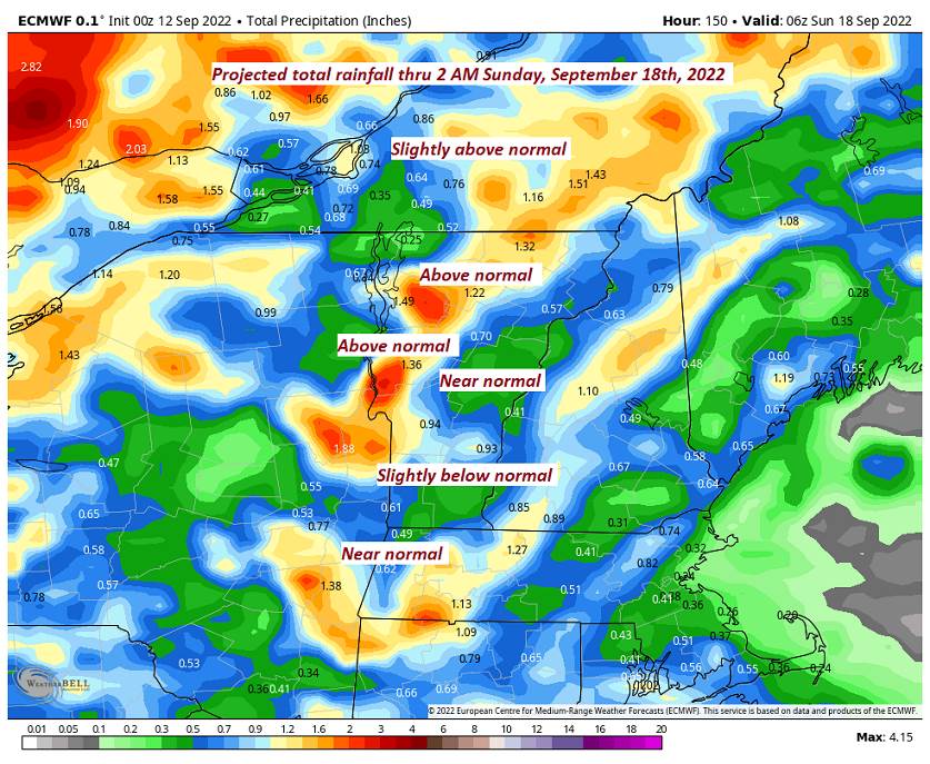
TOMORROW: Mostly cloudy, a breaks of sun. Muggy but not to warm. Showers likely with embedded thunderstorms, one or two strong and locally heavy. A high in the lower 70s. Southeast winds 10 mph.
TUESDAY NIGHT: Evening clouds. A few leftover showers exiting to partial clearing. A low around 55. South to southwest winds 10 mph
WEDNEDAY: Partly to mostly cloudy & blustery. Scattered showers, mainly northern areas. A high near 70. Gusty northwest breeze 10 to 20 mph.
Looking Further Ahead…
WEDNESDAY NIGHT: Partly to mostly cloudy. A low in the mid-40s.
THURSDAY: Some lingering cloudiness northern areas, mostly sunny central and southern areas. A high 60 to 65.
FRIDAY: Sunshine mixed with afternoon clouds. A low 40 to 45. A high in the mid-60s.
SATURDAY: Sunshine mixing with high clouds. A low around 40. A high in the mid-60s.
SUNDAY: Filtered sun thru high clouds, warmer and little humid. A low near 50. A high 75 to 80.
Average lows mid-40s to low 50s. Average highs upper 60s to low 70s

RH/9-12[forecast][end]
