
TONIGHT: Fair early then increasing/thickening high clouds. A low near 55. Light southeast winds.
TOMORROW: High cloudiness early, gives way to lots of afternoon sunshine central and northern areas. Warmer & more humid. A high 80 to 85. Southwest breeze 10 mph.
SATURDAY NIGHT: Mostly clear with some high cloudiness. A low 55 to 60. Light south winds.
SUNDAY: Sunshine with some high cloudiness. Humid. An isolated shower or thunderstorm. Warmer. A high around 85. West to northwest breeze 10 mph.
Looking further ahead…
SUNDAY NIGHT: Mostly clear. A low in the lower 60s.
MONDAY: Filtered sun then variable cloudiness and muggy. Showers & thunderstorms developing in the afternoon into Monday night…possibly heavy at times A high in the upper 80s to near 90.
TUESDAY: Sunshine mixing with afternoon clouds. Widely scattered afternoon showers and thunderstorms. A low in the
mid-60s. A high 80 to 85.
WEDNESDAY: Morning clouds then partly sunny Kind of muggy. A low in the low 60s. A high near 85.
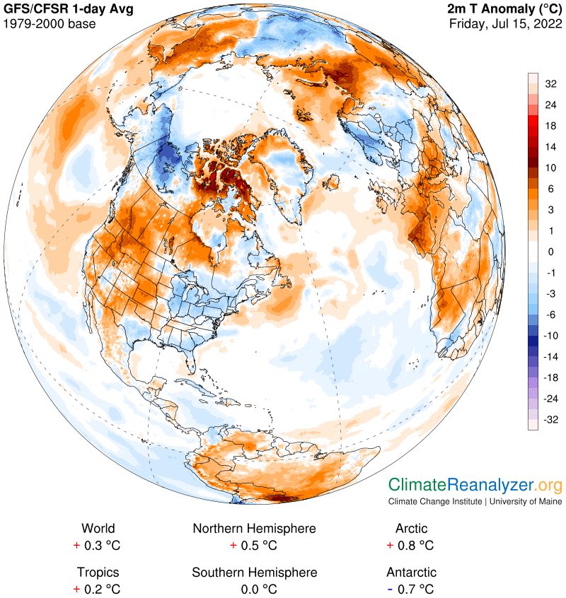
Average lows mid-50s to low 60s. Average highs upper-70s to low 80s.
RH/7-15[forecast][end]
