
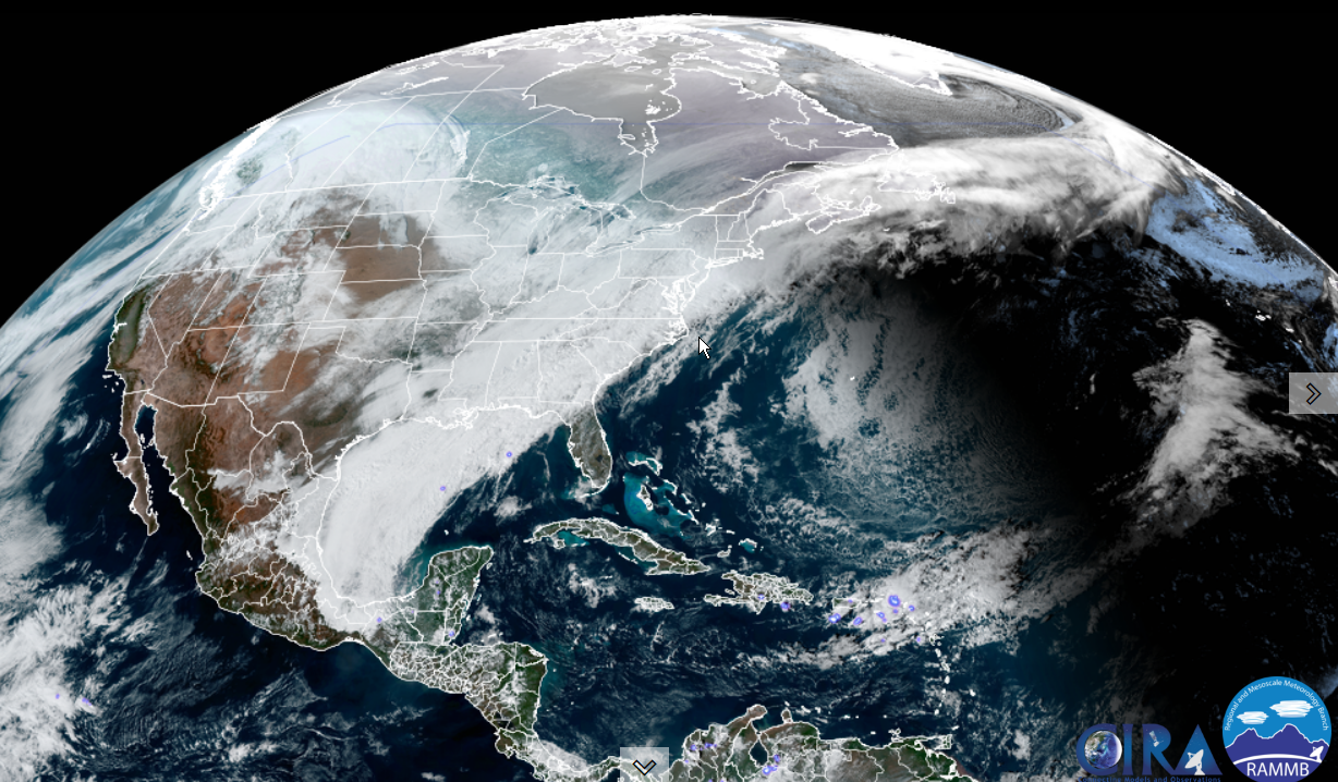
Winter Storm Warning extended thru early evening…
TONIGHT: Becoming partly to mostly cloudy. Light snow early, winds down to scattered flurries. Dusting to an inch. Cold. A low zero to 5 above. Light northwest winds.
TOMORROW: Morning clouds with any leftover flurries exiting, then increasingly sunny. Blustery at times in the afternoon and cold. A high ranging upper single digits to near 15. Northwest winds 10 to 15 mph with cold wind chills.
SATURDAY NIGHT: Mostly clear and frigid. A low 5 to 15 below. Light northwest winds.
SUNDAY: More sun than clouds. A high upper teens to around 20. Light southeast winds.

Looking further ahead…
SUNDAY NIGHT: Partly cloudy. A low 5 to 10 above.
MONDAY: Mostly cloudy. Maybe a brief flurry. A high 25 to 30
TUESDAY: Partly to mostly cloudy. A low zero to 10 above. A high 30 to 35.
WEDNESDAY: Partly to mostly sunny. A low 10 to 15. A high in the mid-30s.
Average lows 5 to 15. Average highs ranging mid-20s to low 30s.
End of Met. Winter March 9th
RH/2-3 forecast][end]
