
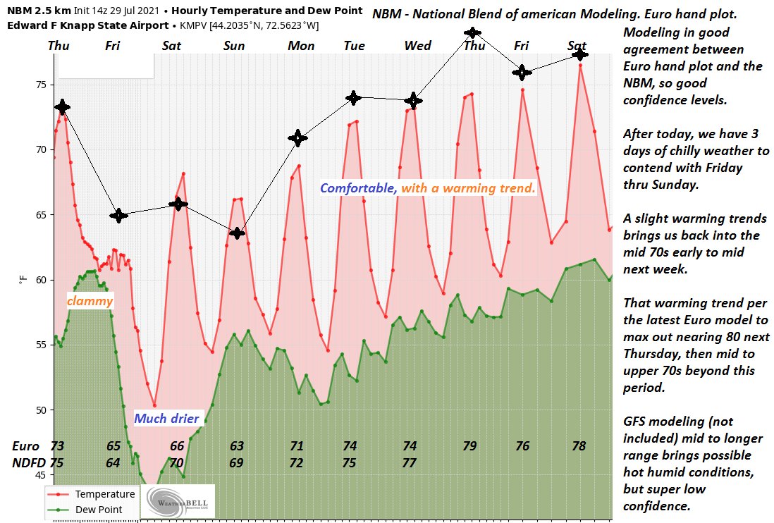
TONIGHT: Cloudy & damp. Showery periods, at times moderate, with rumble of thunder. Areas of fog. A low ranging thru the 50s. Light and variable wind.
TOMORROW: Scattered showers tapering off to isolated sprinkles late afternoon. Otherwise, clouds give way to intervals of afternoon sunshine, cool & blustery at times. A high around 65. Northwesterly winds 10 to 25 mph & gusty.
FRIDAY NIGHT: A few early evening clouds, then clearing. Chilly. Patchy valley fog. A low down to around 50. Light northwest winds.
SATURDAY: Morning fog, then more sun than clouds. Still rather cool. A high in the mid-60s. Northwest breeze 10 mph in the afternoon.
Looking further ahead…
SATURDAY NIGHT: Variable high cloudiness, otherwise fair and dry. A low mid to upper 40s.
SUNDAY: Thickening clouds leading to a chance for showers…moderate at times. A high around 65.
MONDAY: Intervals of sunshine. Chance for showers exiting later in the day. Warming trend. A low near 55. A high in the lower 70s.
TUESDAY: Morning sunshine, then afternoon cloudiness. A low 50 to 55. A high 70 to 75.
Average low mid-50s to low 60s. Average highs in the low-70s to around 80.
Warmest surface water temperatures early August based off local lake climatology.
RH/7-29forecast][end]
