
TODAY: Mainly cloudy & blustery in the afternoon. Scattered afternoon snow showers with light accumulation in the hills. A high in the mid-30s. Southwest winds 10 to 20 mph.
TONIGHT: A few light flurries in the evening exiting, then clearing partially moonlit. A low around 25. West to southwest winds 10 mph.
THURSDAY: Clouds northern areas but with periods of sunshine. A high around 40. Light south to southwest winds.
Looking further ahead…
THURSDAY NIGHT: Variable high clouds. A low 30 to 35.
FRIDAY: Clouds mixed with intervals of sun. Chance for rain showers mixed wet snow later in the afternoon developing southern Vermont. A high in the mid-40s.
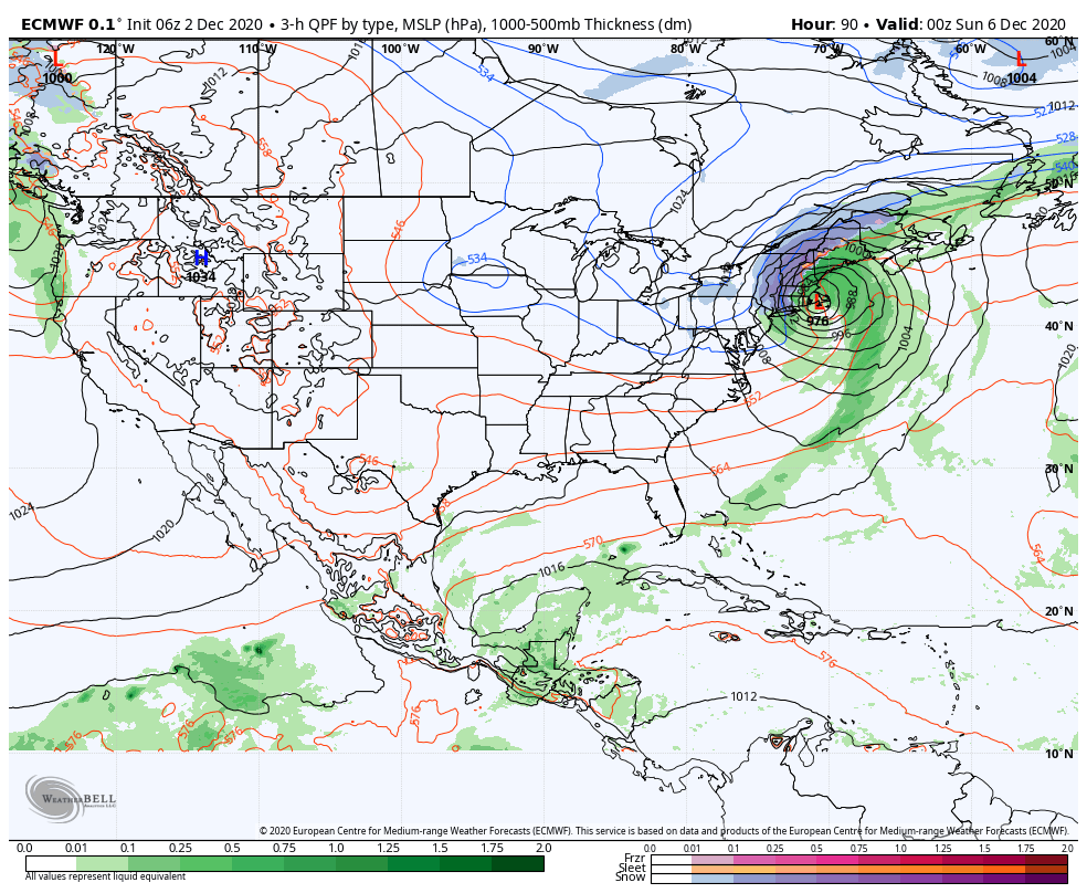
SATURDAY: Overcast. Chance for rain…transitioning to wet snow. Moderate accumulation possible, especially in the Green Mountains. A low mid-20s. A high in the mid-30s.
SUNDAY: Blustery & turning colder. Periods of morning snow tapering to scattered snow showers & flurries. Temperatures falling through the 20s.
MONDAY: Mostly cloudy. Lingering widely scattered snow showers and flurries with light accumulation. A low in the upper teens. A high in the 20s.
Average low mid-teens to mid-20s, Average highs mid-30s to around 40.
RH/12-2 category forecast][end]
