
TODAY: Morning sunshine gives way increasing high cloudiness this afternoon. Hot and steamy. A high upper 80s to around 90. Heat indices low to mid 90s. Southeast breeze 10 mph.
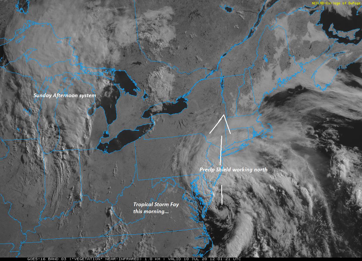
TONIGHT: Clouding up. Rising likelihood for showers southern areas spreading northward. Oppressive and uncomfortable but becoming breezy. A low in the low 70s. Southeast breeze developing 10 to 20 mph overnight.
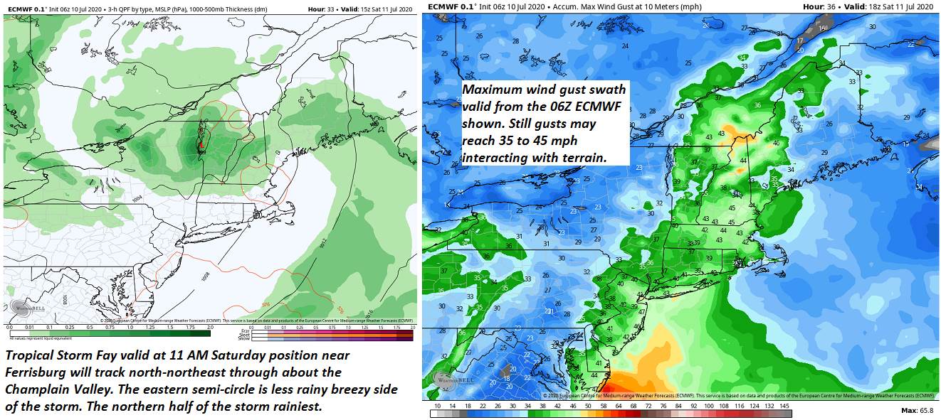
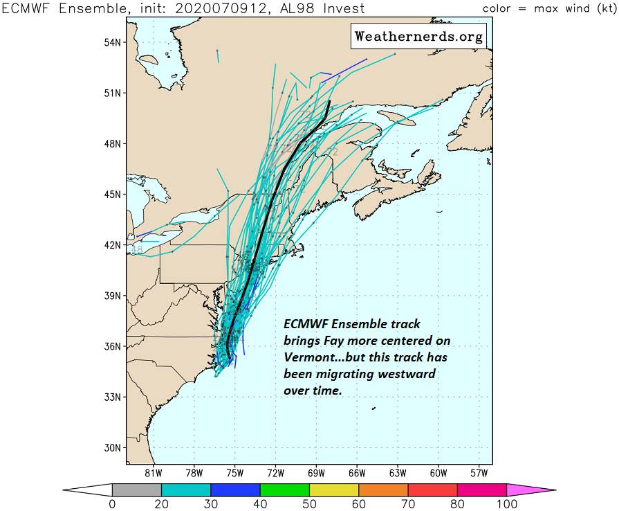
SATURDAY: Gray. Breezy to windy. Periods of rain… moderate to heavy at times through late morning, Intervals of sun developing with widely scattered showers and thunderstorms in the afternoon. Steamy but not as warm with a high around 80. South to southeast breeze 10 to 25mph with higher gusts shifting southerly late.
Looking further ahead…
SATURDAY NIGHT: Evening showers with isolated thunderstorm early, then partly cloudy with areas of fog. Oppressive and uncomfortable with a low near 70.
SUNDAY: Partly cloudy. Good chance for showers and afternoon thunderstorms…some may be strong with heavy downpours. A high around 80.
MONDAY: Mixed sun and afternoon cloudiness. Chance for mainly late afternoon showers and thunderstorms. A low around 65. A high 75 to 80.
TUESDAY: Partly sunny. Widely scattered showers and afternoon thunderstorms. A low upper 50s to 60. A high 75 to 80.
Average lows mid-50s to low 60s, average highs upper-70s to low 80s.
RH/7-10[end]
