

TONIGHT: Mostly clear. Oppressive and uncomfortable. A low in the upper 60s. Light southeast winds.
TOMORROW: Partly to mostly sunny, hot and steamy. A high upper 80s to around 90. Heat indices low to mid 90s. Southeast breeze 10 mph.
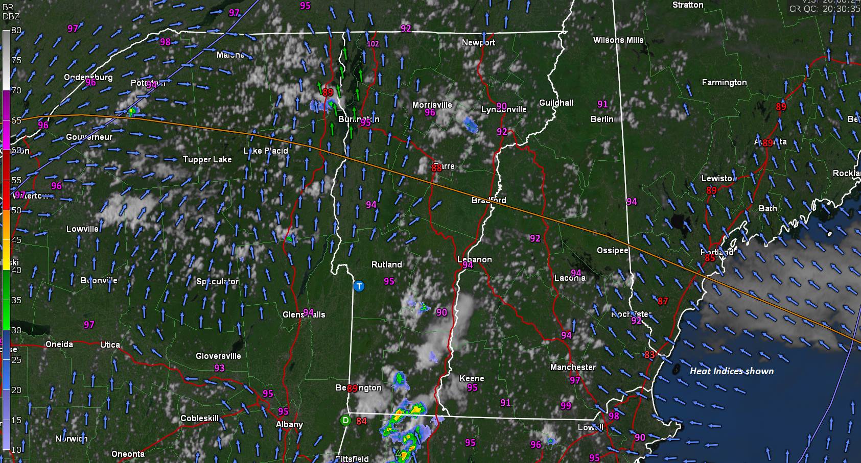
FRIDAY NIGHT: Increasing and thickening clouds. Oppressive and uncomfortable. A low around 70. Southeast breeze 10 mph.

SATURDAY: Considerable cloudiness and becoming breezy. Frequent showers or periods of rain likely, moderate to heavy at times with isolated thunder. Very muggy, but not so hot. A high upper 70s to around 80. South to southeast breeze 10 to 20 mph shifting southwesterly late.
Looking further ahead…
SATURDAY NIGHT: Mainly cloudy with chance for evening showers exiting. Oppressive and uncomfortable with a low near 70.
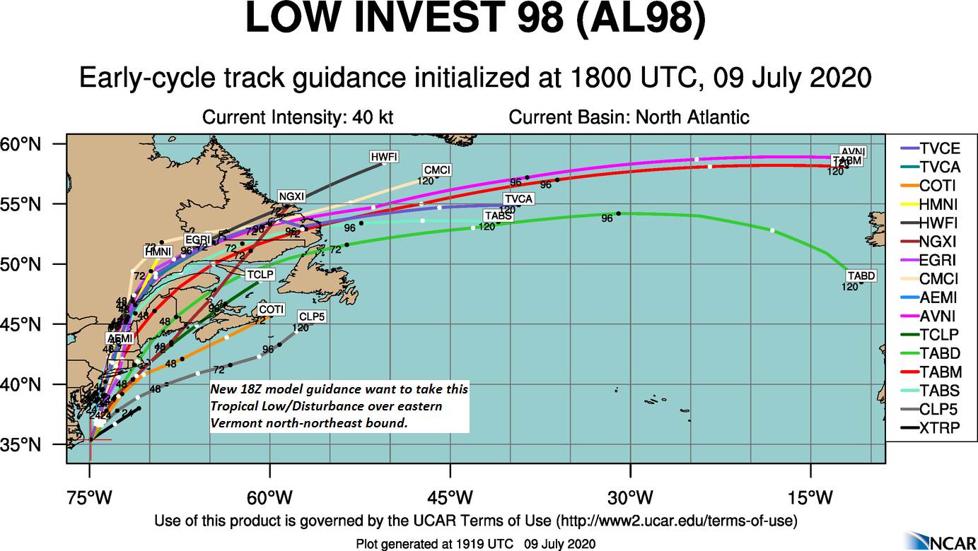
SUNDAY: More clouds than sun. Scattered heavy showers with possible afternoon thunderstorms. A high around 80.
MONDAY: Mixed sun and afternoon cloudiness. Chance for showers and isolated thunderstorms. A low around 65. A high 75 to 80.
TUESDAY: Mainly cloudy. Chance for showers and possible thunderstorms. A low upper 50s to 60. A high 75 to 80.
Average lows mid-50s to low 60s, average highs upper-70s to low 80s.

RH/7-9[end]
