
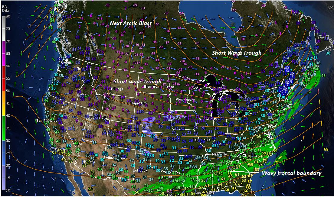
TODAY: Mostly cloudy with scattered flurries north of the Barre-Montpelier area thru late morning. Clouds mixed with periods of sun central and southern areas. Blustery. Early high 30 to 35 this morning, but falling through the 20s this afternoon. West to northwesterly winds flare up at 10 to 25 mph and gusty.
TONIGHT: Partly cloudy. Chance for a few stray mountain flurries. A low around 5 above. Light northwest winds.
THURSDAY: Scattered flurries, then partial or better afternoon sunshine. A high around 15. Northwest winds 10 mph.
Looking further ahead…
THURSDAY NIGHT: Mostly clear. A low zero to 10 below.
FRIDAY: Sunny but cold. A high near 20.
SATURDAY: A few morning clouds then mostly sunny and milder. A low around 10 above. A high in the mid-30s.
SUNDAY: Sunshine with a few high clouds. A low 15 to 20. Possible Sap run. A high near 40 degrees.
MONDAY: Filtered morning sun, then clouding up. Chance for rain with a possible wintry mix at onset. A low 20 to 25. A sap run possible with a high near 45.
Average lows upper single digits to mid-teens, average highs low to mid-30s.

RH/2-19[end]
