
TONIGHT: Cloudy with considerable areas of fog. Occasional mountain snow showers and flurries develops toward midnight, less than an inch accumulation. A low in the mid-20s. Partial clearing develops late. West winds pick up 10 to 20 mph overnight.
TOMORROW: Pick of the week. A few morning flurries exit the Northeast Kingdom, then more sunshine than clouds. A high around 32 degrees. West winds 10 to 20 mph in the morning, falling off in the afternoon.
WEDNESDAY NIGHT: Fair in the evening, then thickening clouds. Light snow likely before daybreak. A low in the upper 20s. South winds 10 mph.
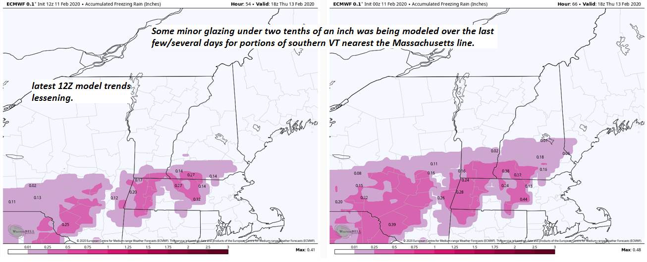
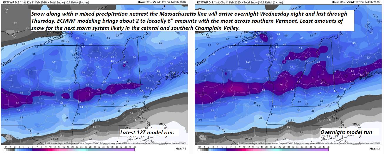
THURSDAY: Overcast. Snow likely, moderate at times. Accumulation about 3 to 6”. Mixed precipitation with some glazing across far southern areas. A high in the lower 30s. Light northwest winds.
Looking further ahead…
THURSDAY NIGHT: Light snow tapers to scattered flurries. Some minor additional accumulation. Otherwise mostly cloudy. A low zero to above.
FRIDAY: Scattered flurries. Breaks of sunshine but much colder. A high 5 to 10 above.
SATURDAY: Mostly sunny. Frigid. A low 10 to 20 below. A high 10 to 15.
SUNDAY: Mixed clouds and sun. Chance for a few flurries. A low around 10 above. A high reaching into the upper 20s.
Average lows upper single digits to mid-teens, average highs upper 20s to mid-30s.
RH/2-11[end]
