
-
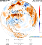
- image001 3
-

- image002 12
TONIGHT: Partly cloudy to mostly clear & fully moonlit skies. A low mid to upper 50s. Light southwest winds.
TOMORROW: Mixed clouds and sun. Scattered afternoon showers and thunderstorms especially northern areas. Sticky. A high near 75. Light southwest winds.
WEDNESDAY NIGHT: Partly cloudy early then clouding up. Chance for leftover shower mainly northern areas. Humid. A low around 60. Light southeast winds.
THURSDAY: Considerable cloudiness. Showers becoming likely in the afternoon with a risk for a thunderstorm…possibly moderate to heavy. A high in the low 70s. Light winds.
Looking further ahead…
THURSDAY NIGHT: Periods of rain with a chance for thunderstorms especially in the evening. A low in the mid to upper 50s.
Summer Solstice 11:54 AM Friday…
FRIDAY: Scattered morning showers exiting. Becoming breezy to windy. A high in the mid to upper 60s.
SATURDAY: Scattered mountain sprinkles, otherwise clouds mixing with more sun. A low in the low 50s. A high upper 60s to near 70.
SUNDAY: Mixed sun and clouds, blustery at times. A low in the 50s. A high 70 to 75.
Average lows in the low to mid 50s. Average highs in the mid to upper 70s.
RH/6-18-19[end]
