
TODAY: Morning fog burns of to lots of sunshine with some high cloudiness. A high in the mid 60s. Little wind.
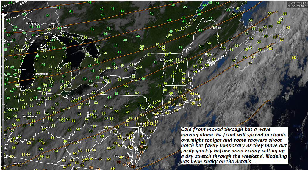
TONIGHT: Thickening clouds leading to scattered showers mainly after midnight. A low 50 to 55. Light southeast winds.
FRIDAY: Slight chance for a leftover sprinkle in the morning, then more sun than clouds in the afternoon. A high in the mid 60s. Southwest winds 10 mph.
Looking further ahead…
FRIDAY NIGHT: Partly cloudy. Patchy valley fog. A low near 50.
SATURDAY: Morning clouds, then partly sunny. A high in the mid 60s.
SUNDAY: Mixed sun and clouds. A low 40 to 45. A high in the upper 50s to low 60s.
MONDAY: Becoming unsettled. Lots of clouds with a chance for showers. A low 40 to 45. A high 55 to 60.
TUESDAY: Cloudy and gray. A chance for showers. A low in the 50s. A high in the around 70.
WEDNESDAY: Gray skies with a chance for showers. A low in the 50s. A high in the 60s.
Average lows 40 to 45. Normal highs 60 to 65.
RH/9-27-18[end]
| Virus-free. www.avast.com |
