
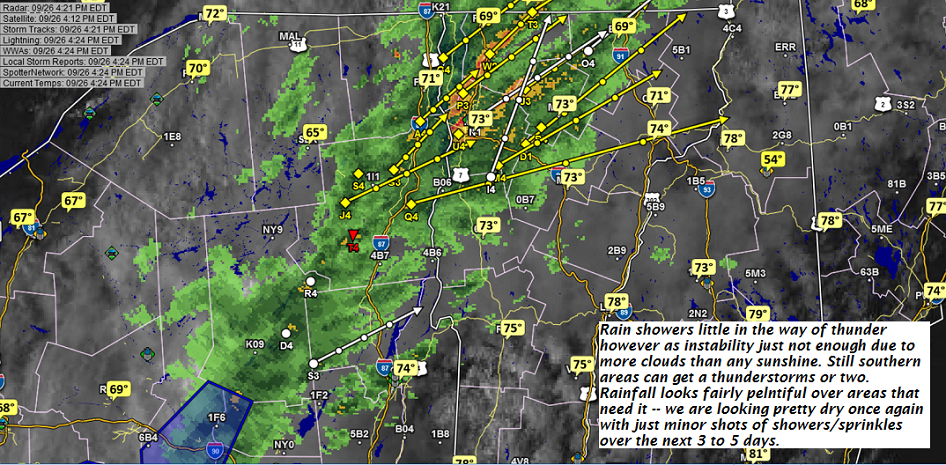
TONIGHT: Evening showers and isolated thunderstorms, some locally heavy exiting by late evening. Otherwise partial clearing and moonlit with patchy valley fog. A low near 50. Light northwest winds.
TOMORROW: Areas of morning burning off to lots of sunshine with few high clouds. A high 60 to 65. Little wind.
THURSDAY NIGHT: Clear and moonlit evening, then increasing clouds. Slight chance for a sprinkle. Patchy valley fog. A low in the low 50s. Light southeast winds.
FRIDAY: Slight chance for a sprinkle, then partly to mostly sunny. A high in the upper 60s. Southwest winds 10 mph.
Looking further ahead…
FRIDAY NIGHT: Partly cloudy. Patchy valley fog. A low near 50.
SATURDAY: Morning clouds, then partly sunny. A high in the mid 60s.
SUNDAY: Mixed sun and clouds. A low upper 30s to low 40s. A high 55 to 60.
MONDAY: Becoming cloudy with a chance for rain or showers. A low 35 to 40. A high near 60.
Average lows in the low to mid 40s. Normal highs 60 to 65.
RH/9-26-18[end]
| Virus-free. www.avast.com |
