
TODAY: Cloudy. Periods of rain or showers becoming likely by late morning. Continued raw with a high mid 50s to near 60. Southeast breeze 10 to 20 mph.
TONIGHT: Evening showers exiting, otherwise mainly cloudy. Temperatures holding in the 50s. Southeast breeze 10 to 20 mph.
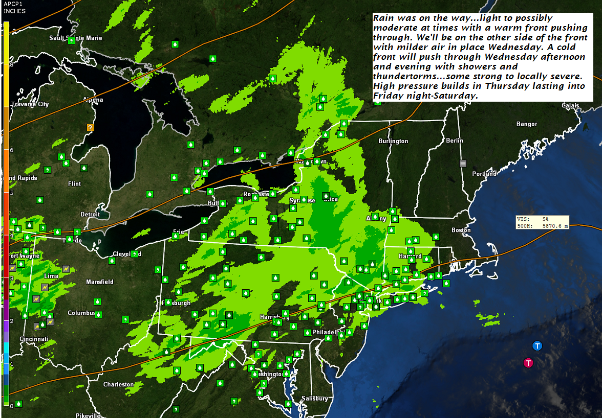
WEDNESDAY: Widely scattered showers, otherwise clouds mixed with periods of sunshine. Showers and thunderstorms developing later in the afternoon…some strong to locally severe. Milder and rather muggy with a high around 75. Southwesterly breeze 10 to 20 mph.
Looking further ahead…
WEDNESDAY NIGHT: Evening showers and thunderstorms exiting before midnight then partial clearing. A low near 50.
THURSDAY: Areas of morning fog gives way to lots of sunshine with high cloudiness. A high 60 to 65.
FRIDAY: Lots of sunshine with a few high clouds. A low near 50. A high around 70.
SATURDAY: Any morning sun gives way to thickening clouds leading to a chance for afternoon showers. A low near 50. A high in the 60s.
SUNDAY: Clouds mixed with intervals of sunshine. A low 35 to 40. A high in the mid 50s.
Average lows in the low to mid 40s. Normal highs not too far from 65.
RH/9-25-18[end]
| Virus-free. www.avast.com |
