
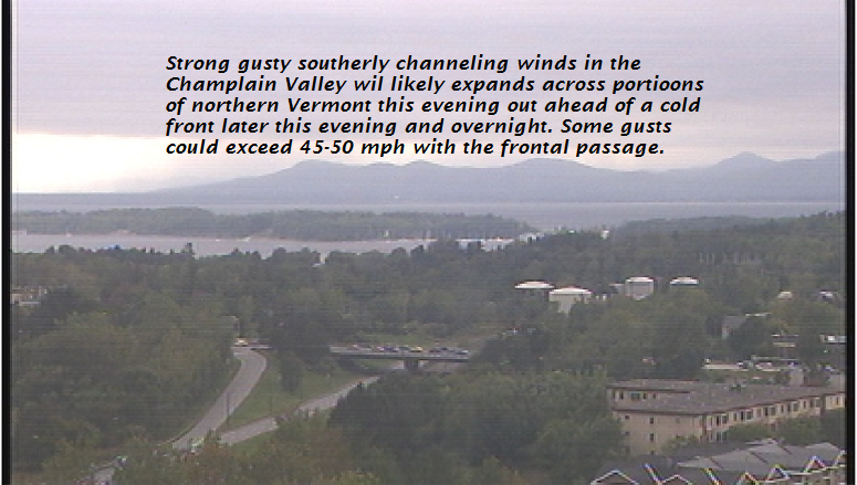
TONIGHT: Cloudy. A round of showers developing late this evening into the early morning hours. A risk for a thunderstorm. A low 50 to 55. South to southwest breeze 10 to 25 mph shifting to northwesterly with higher gusts possible.
TOMORROW: Mostly cloudy in the morning. Partly to mostly sunny in the afternoon. Cool & blustery at times with a high in the upper 50s. Northwest winds 10 to 15 mph.
Autumnal Equinox 9:54 PM Saturday Evening…
SATURDAY NIGHT: Mostly clear with some high cloudiness. Patchy valley fog. A low around 40. Little wind.
SUNDAY: Sunshine mixing with clouds mainly northern areas. A high 60 to 65. Northwest breeze 10 mph.
Looking further ahead…
SUNDAY NIGHT: Clear and colder. A risk for spotty frost. A low in the mid 30s colder spots to around 40 elsewhere.
Full Harvest Moon 10:52 PM Monday Evening…
MONDAY: Morning sun then more clouds in the afternoon. A high near 60.
TUESDAY: Thickening clouds, then a rising chance for showers. A low around 45. A high in the low 60s.
WEDNESDAY: Gray with a chance for showers exiting in the afternoon. A low 55 to 60. A high in the mid 60s to near 70.
THURSDAY: Filtered sunshine through high clouds. A low in the upper 40s. A high 60 to 65.
Average lows in the mid to upper 40s. Normal highs in the mid 60s to near 70.
RH/9-21-18[end]
| Virus-free. www.avast.com |
