
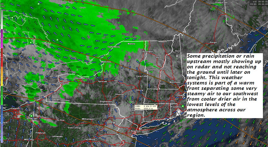
TONIGHT: Mainly cloudy. Chance for light showers developing overnight. A low around 55. Southeast winds 10 mph overnight.
TOMORROW: Showers through about mid day, Otherwise clouds a few breaks of sun. Breezy in the afternoon with a high 65 to 70. Gusty south winds 10 to 20 mph in the afternoon.
FRIDAY NIGHT: Cloudy. Showers likely late evening on. A risk for a thunderstorms. A low 50 to 55. South to southwest breeze 10 to 25 mph and gusty.
SATURDAY: Chance for showers early, giving way to increasing sunshine. Cooler & blustery at times. A high in the upper 50s to near 60. Northwest winds 10 to 20 mph.
Looking further ahead…
Autumnal Equinox 9:54 PM Saturday Evening…
SATURDAY NIGHT: Mostly clear isolated valley fog. A low in the upper 30s to low 40s.
SUNDAY: Sunshine mixing with clouds in the afternoon. A high near 60.
Full Harvest Moon 10:52 PM Monday…
MONDAY: Patchy valley fog then mostly sunny. A risk for areas of morning frost. A low in the mid 30s. A high near 60.
TUESDAY: Morning sunshine then, then thickening clouds leading to a chance for showers late. A low around 45. A high in the low 60s.
Average lows in the mid to upper 40s. Normal highs in the mid 60s to near 70.

RH/9-20-18[end]
| Virus-free. www.avast.com |
