
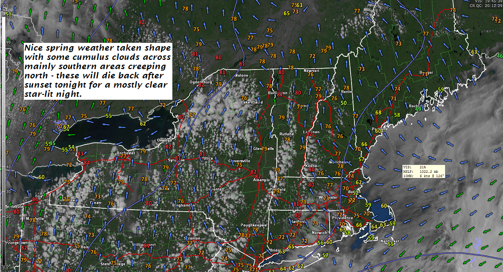
TONIGHT: Mostly clear and starlit skies. A low 45 to 50. Light south winds
TOMORROW: Morning sunshine quickly gives way to increasing clouds. Showers arriving in the afternoon, maybe a rumble of thunder late. A high in the low 70s. South winds 10 to 20 mph
THURSDAY NIGHT: Mostly cloudy with scattered rain showers exiting before daybreak. A low around 35 with a frost threat northern areas. Northwest winds 10 to 20 mph.
FRIDAY: A few morning clouds then lots of sunshine. A high 50 to 55. Northwest breeze 10 to 15 mph.
Looking further ahead…
FRIDAY NIGHT: Fair early, then thickening clouds. An early low 32 to 35 with scattered areas of frost.
SATURDAY: Considerable cloudiness most of the area with chance for showers. Dry with hints of sun across far northern areas. A high in the upper 40s to mid 50s warmest northern areas.
SUNDAY Mother’s Day: Sunshine filtered through periodic high cloudiness but dry. A low in the 40s. A high upper 50s to mid 60s.
MONDAY: Sunshine mixing with afternoon clouds. A low 35 to 40. A high 65 to 70.
TUESDAY: Mostly sunny. A low 40 to 45. A high 70 to 75.
WEDNESDAY: Partly cloudy. Scattered showers and a chance for thunderstorms. A low 45 to 50. A high 75 to 80.
Average lows 40 to 45. Normal highs around 65.
RH/5-9-18[end]
| Virus-free. www.avast.com |
