
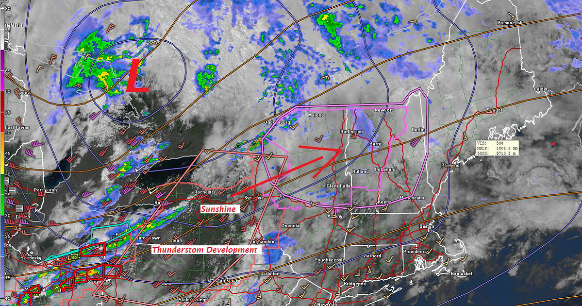
Tornado Watch through 10 PM Wind Advisory tonight through daybreak Saturday…
TONIGHT: Variably cloudy. A couple of rounds of strong to severe thunderstorms winding down toward midnight. Breezy to windy. A low in the mid 40s. West winds 10 to 25 with higher gusts over 40 mph across intermediate and higher terrain.
TOMORROW Green Up Day: Morning cloudiness gives way to increasing sunshine. Sill breezy to windy…diminishing through the day. A high in the mid 60s. West northwest winds 10 to 25 mph gradually diminishing.
SATURDAY NIGHT: Mostly clear. A low around 45. Light winds.
SUNDAY: Morning sun mixing with more clouds. Scattered showers developing in the afternoon. A high in the mid to upper 60s. Light southwest winds.
Looking further ahead…
SUNDAY NIGHT: Chance for showers, mixed with a few wet snow flakes in the high terrain. A low in the mid to upper 30s.
MONDAY: Bright sunshine and blue skies but rather cool. A high in the mid to upper 50s
TUESDAY: Sunny and gorgeous after some frost in the morning. A low 30 to 35 with scattered areas o9f frost. A high 65 to 70.
WEDNESDAY: Blue skies and bright sunshine. A low around 40. A high in the upper 60s.
THURSDAY: Morning sunshine then increasing high clouds. A low in the 40s. Warmer. A high in the upper 60s to mid 70s.
Average lows upper 30s to low 40s. Normal highs in the low to mid 60s.
RH/5-4-18[end]
| Virus-free. www.avast.com |
